This website will be updated and augmented continually. You are invited to visit it on a regular basis.
New publication on 10Be age datings of landforms (erratics) in Vorarlberg and southern Germany: www.inatura.at/forschung-online/ForschOn_2023_106_0001-0008.pdf
Two ESRI ArcGIS storymaps have been made illustrating the research Surface and Subsurface Resources is involved with recently:
https://arcg.is/Xjvy4
https://bit.ly/vorarlberg-storymap
Established in 2003, Surface and Subsurface Resources is a geological consultancy specializing in research and applications in Quaternary geology and in petroleum geology.
Based on decades of work in the Alps of Vorarlberg (Austria) and the alpine foreland of southern Germany, Surface and Subsurface Resources (SSR, aka susures) has developed a thorough understanding of the Quaternary landscape development of mountainous areas and adjacent forelands. Glacial erosion, deposition of glacial and fluvioglacial sediments, fluvial processes and mass movements have jointly created the landscape as we see it today. And the landscape is still changing and will always change. A thorough knowledge of the landscape and the formative processes form the basis for the work on geoconservation, which is the present focus of SSR. Work is carried out in close cooperation with the Research Foundation for Alpine and Subalpine Environments. For further information please click the link www.rfase.org below.
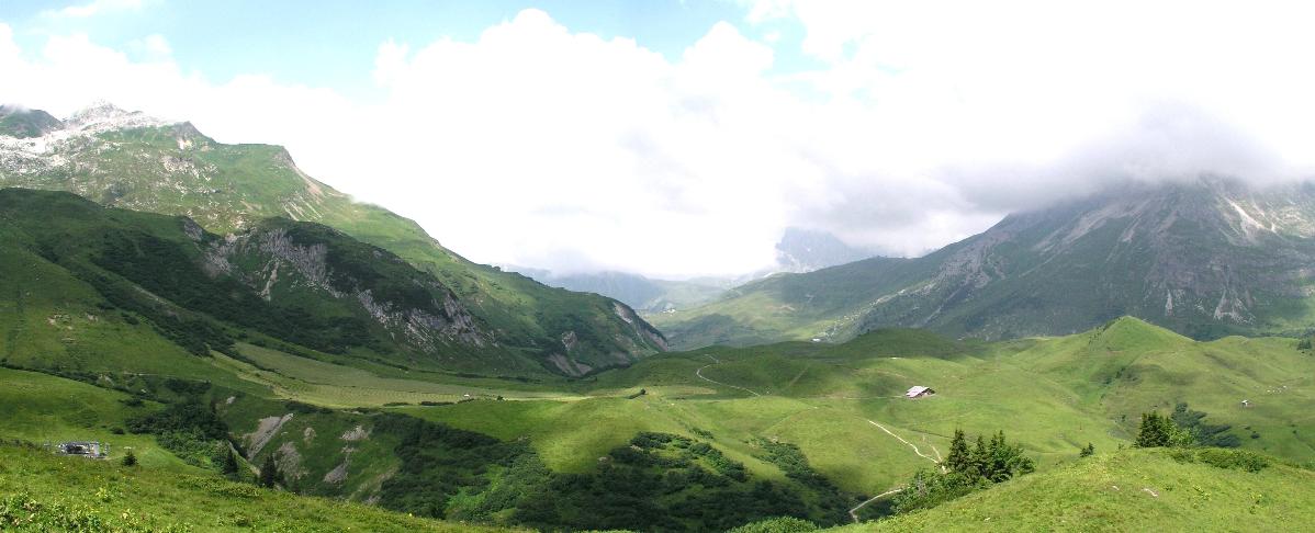
The Hoher Bühel area in the municipality of Lech (Vorarlberg, Austria) seen from Oberlech. The geoconservation potential of this and other areas in Vorarlberg and Liechtenstein has been assessed by Seijmonsbergen, De Jong, de Graaff and Anders (2014).
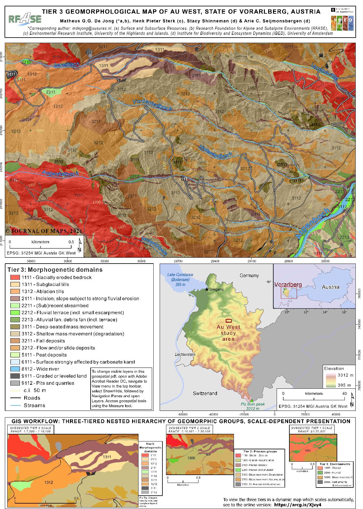
Method of hierarchical geomorphological mapping llustrated by the example of the Au West (Vorarlberg, Austria) maps (De Jong et al., 2021, see tab Publications). A high-quality geospatial pdf of this panel can be downloaded from https://doi.org/10.1080/17445647.2021.1897047. A dynamic visualization of the mapping method is available at https://arcg.is/Xjvy4.
The petroleum geological services of SSR revolve around the analysis of depositional trends in lithological data as recorded in wireline logs from drill holes. Time-equivalent vertical lithofacies changes and trends are identified in the data and correlated between wells. The resulting high-resolution well-to-well correlation framework forms the basis for exploration and production work: sediment distribution patterns can be analyzed within a framework of (near-)synchronous boundaries and reservoir property models can be constructed for oil and gas fields. The method can be used as a stand-alone tool in barren sequences (such as the Upper Rotliegend redbeds of the Southern Permian Basin) and in combination with other stratigraphic techniques (e.g. in combination with palynostratigraphy in the Carboniferous of the Southern North Sea).
The technique has also been used to analyze isotope and ion data from Greenland ice cores in search of potentially meaningful boundaries and units (stratigraphy). The suggestion is that such boundaries and units have climatic significance.
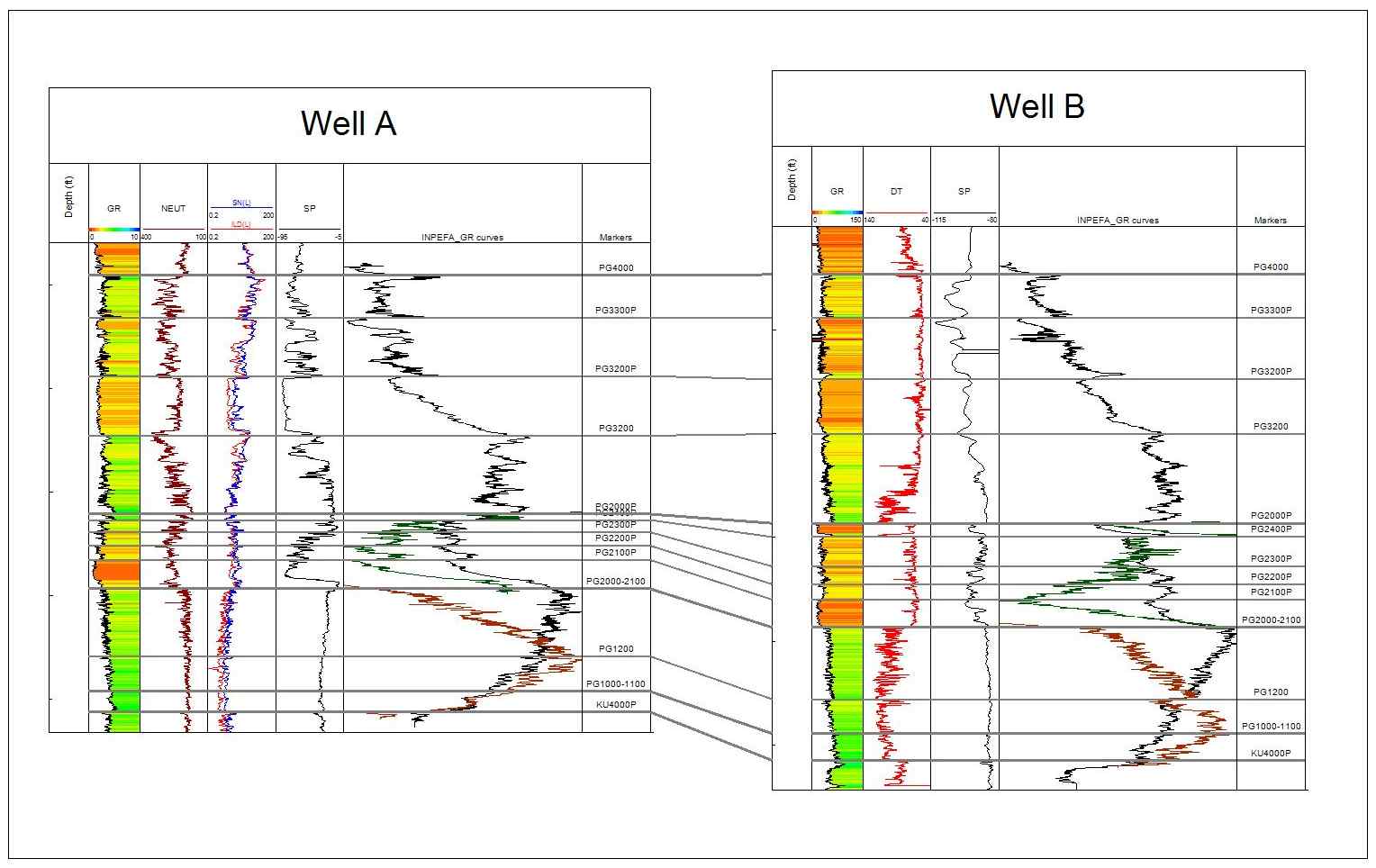
Well-to-well correlation of Paleogene carbonates and fine-grained deposits. Lateral and vertical lithofacies changes can be analyzed within a framework of near-synchronous boundaries. The analysis and interpretation are supported by CycloLog-based INPEFA-curves.
Well-to-well correlation of the Rotliegend in two wells from the K2b-A Field in the Dutch offshore. Understanding the nature and distribution of the sands greatly benefited from generating a stratigraphic framework of the fine-grained section based on the identification of near-synchronous flooding surfaces. Refer to thepublication by De Jong et al. (2020) under the tab Publications for further explanation.
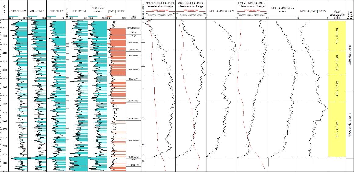
Correlation techniques developed in subsurface geology have been applied to oxygen-isotope data and [Ca2+] data from ice cores of the Greenland Ice Sheet to generate a stratigraphic subdivision with climate significance. Refer to the publication by De Jong et al. (2019) under the tab Publications for further explanation.

High-resolution stratigraphic subdivision of data from ice cores of the Greenland Ice Sheet. Refer to the publication by De Jong et al. (2019) under the tab Publications for further explanation.
For further information please send an e-mail to:
© Copyright Surface and Subsurface Resources